


Discovering the Beauty of the North: A Cyclist’s Journey on the Sagada Loop
The Philippines is a country blessed with a diverse range of natural beauty, from its pristine beaches to its lush mountains. And what better way to explore this beauty than on a bike ride? Rommel Fernandez, an experienced cyclist and adventurer, recently embarked on a journey to explore the northern region of the Philippines, specifically the Sagada Loop.
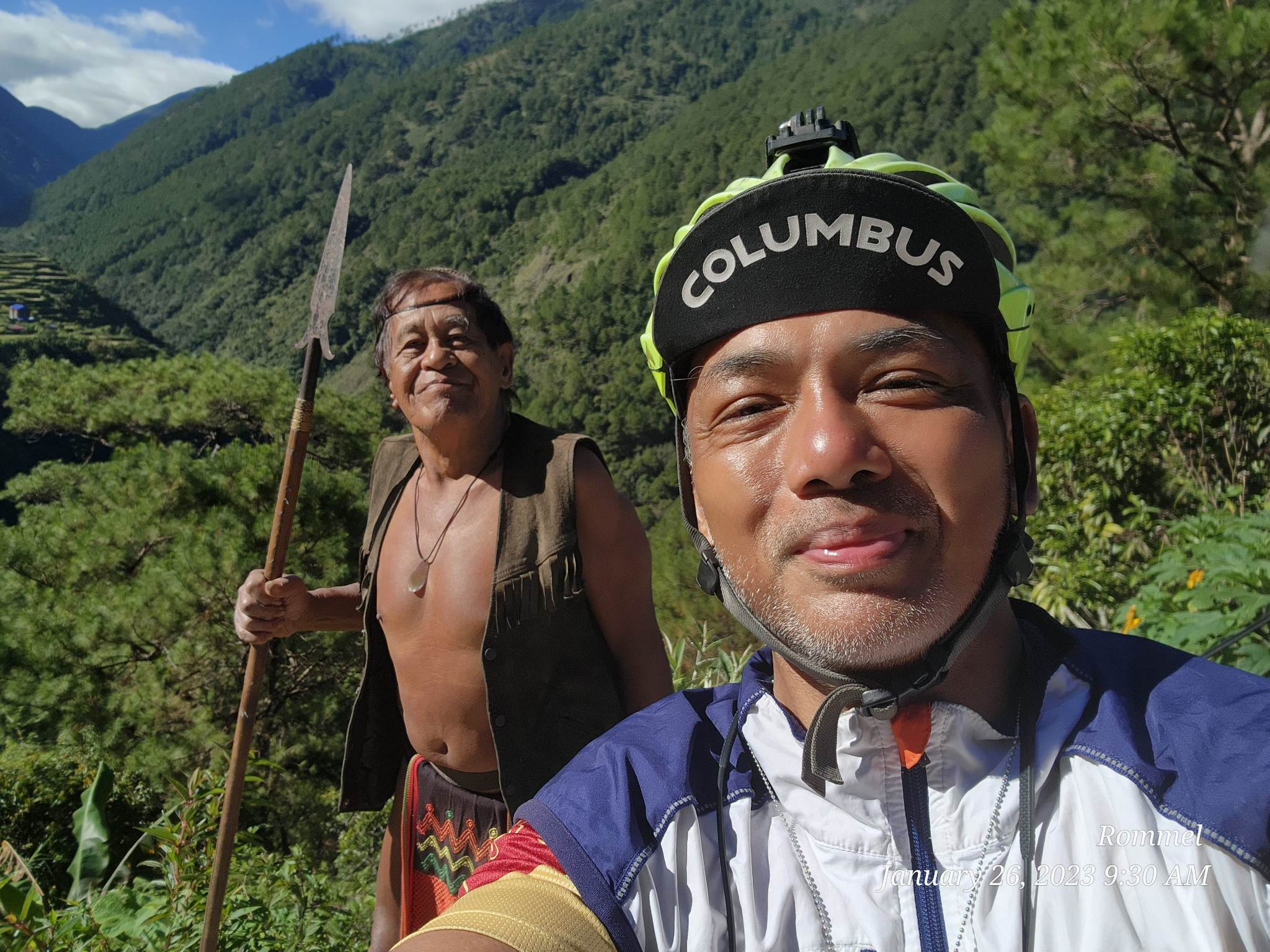
In this interview, we dive deeper into Rommel Fernandez’s experience during his Sagada Loop Bike Ride, a grueling 1,300-kilometer journey across the northern part of the Philippines. From his training to the challenges he faced on the road, Rommel shares his thoughts on the physical and mental toll of the ride, the local culture and food he encountered, and how he balanced the need to capture and document his experience with the demands of the ride. Join us as we explore the ins and outs of Rommel’s epic adventure.
What inspired you to take on the Sagada Loop Challenge, and how long did you prepare for it?
Way back in 2018, my family went to Sagada for vacation, passing through the same route. I saw how steep, long, and twisty the climbs were, and that’s when I told myself that this could be a great challenge for me: riding from Manila to Sagada and back. It’s 806 kilometers, by the way. Since I can only ride on the weekends, I have to give myself 6 months to prepare. On weekdays, I would only lift weights in the gym to make my legs stronger, and on weekends, that’s when I would usually do back-to-back rides.
What was the type of bike that you used for this journey and what did you bring along with you?
I used a Surly Ogre steel mountain bike with 29 x 2.2 wheels, rear panniers, front handlebar bag, 10 speed 42/32/22 chainring with 36t sprocket. -I brought 2 Ahon polo shirts, 1 Ahon t-shirt, alternating during the ride. 1 thick t shirt for sleeping. -2 shorts, 1 sleeping shorts and 1 cycling shorts. -1 jacket for cold weather and 1rain jacket that’s 360 reflectorized. – 1 compact stove, 1 butane, 1 small frying pan. – 1x 40k and 1x 20k power banks – I stored cooking sets, tools and food on one side of the pannier, these are what i seldom use during the ride. – on the other side are shirts, shorts, jackets, power banks and towels. -Front bag, small power bank, phones and snacks.

Can you walk us through your experience during the ride?
Well, on day 1, when I left Manila at 4:30 a.m., it was cooler than usual, but when I was within the area of Nueva Ecija, the midday temperature there was hot. I suffered from a bad headache due to heat stress, which eventually made me slow down and call it a day. I guess this part of the ride was the only time I wanted to quit. It’s a good thing I brought medicine with me. I tried my luck to stay in San Jose barangay hall, and officers let me sleep in their quarter.

Day 2, somewhere along Carranglan, Nueva Ecija, the road is too narrow, and trucks would push me to use the gravelly shoulder of the road. This eventually tore my rear tire irreparably; fortunately, I brought a spare tire with me. Upon reaching Solano, Nueva Vizcaya, I decided to stop and find a place to stay for the night since it was getting dark. I passed by a police station, and the officers gave me a place where I could set up my tent just outside their detachment. I guess it’s the safest place to be at that moment.

The next morning, I headed to Banaue, where the temperature was getting really cold. Upon reaching Banaue, the temperature went down to 8°. It’s really cold and foggy with a light rain shower. My fingers froze, and I had a hard time texting on my phone.

Since it’s getting dark, I had to ask for assistance from the Banaue tourist police for a place to stay for the night.

I was already too far in the area of inns, which is why one of the officers guided me to this restaurant; they knew someone who could accommodate me. It’s where I spent my second night, pitching my tent inside the videoke bar.
It’s free; I just need to buy something from them. Well, that’s a good deal😊 And that’s what I really wanted in the first place—to stay in places like that where I could also meet and mingle with the locals.
Following morning, I left for Sagada. My first major climb was Mount Polis. The view in the morning is truly breathtaking, and I think it’s one of my favorite places to watch the sea of clouds. The climbs are not so steep, but 14 kilometers of relentless climbing with a spectacular view of the sunrise and layers and layers of mountains in the background will truly make anyone stop and enjoy the beauty of the place. I reached the junction exactly at noon, where the climb to Sagada starts.

The weather is hot but forgiving, at least for me, because I was able to conquer the 8 km climb with my 75-pound bike without stopping. It had an average of 8% with a max of, I think, 16% gradient. This is one of my ultimate goals on this ride: to be able to reach Sagada via this road without stopping. My training paid off. I reached Sagada town proper at 3:30 p.m.; yes, I was climbing for more than 3 hours haha 😄 And all I had to fill up my energy was a piece of Cloud 9 chocolate bar and water. I had more in the bag, but I didn’t want to stop. I have reached 405 km at this point, and I can’t believe I have finally reached this majestic place, but I’m only halfway through the journey, and I was told there will be more climbs going to Mt. Data and Baguio. That’s why I had to find a place as soon as possible where I could camp for the night to have a good rest and refuel for the next day.

Sagada is famously known to be a lover’s destination and also for those who want to have a break from the city stress. That’s why there are lots of inns and transient houses in the area for tourists like me, but staying in inns was my last option. I walked around the main road in the town until I met a guy quietly sitting on his chair just in front of his hotel that he owns. I asked him if he knew of a place where I could camp just for the night, and quickly he pointed to that small hill behind his place. He said he knows who lives there and might let me camp. So I went up the hill without really expecting to be given the chance to stay there, and as soon as I saw this house on top of the hill, I immediately fell in love with the place. But at that point, I hadn’t talked to the owner yet. So quietly, I walked in front of the house and saw this guy, shocked to see a stranger in his place. I quickly introduced myself and told him my intentions. After some questioning, he allowed me to camp and even showed me where I could stay, and to my surprise, I was given the best spot on the hill! It has this 360° view of the entire Sagada city. perfect spot to camp. We chatted the whole afternoon, exchanged stories, and happily shared my experiences throughout the trip. He even set up a bonfire for me that night, which he said he seldom does. Kenneth is a great guy.

When morning came, he prepared breakfast for me and even filled my thermos with his Sagada coffee. I didn’t want to leave that soon, but I’m one day behind my planned schedule, and there’s still 400 km to go. So I left, rolled, and headed to Mt. Data around 9 a.m., which is the longest I stayed in the morning. Going up Mount Data, which is in Bauko, Mountain Province, was one of the most memorable climbs ever for me. I started climbing Halsema Highway with some fog at around 11 a.m., and from that point on, cell phone signal was really poor to none. 3 p.m., I reached the detour where the highway is under repair due to a land slide caused by the recent earthquake. Since 11 a.m., fog has thickened, temperatures have gone as low as 14 °C, and visibility has worsened from 200 meters to 50 meters. At this point, it’s really risky to be on the highway on a bike. It’s already 5 p.m., and I’ve arrived at Mount Data Elementary School in Bauko Mountain Province.
There, I asked permission from the teachers if I could stay there just for the night. They allowed me to use their multipurpose hall. I think it’s here where I felt the coldest temperature among all the places, and the foggiest too. As early as 8 p.m., this small town is already quiet and really dark, especially in the streets, where few people are out.

I woke up at 4 a.m., a few hours earlier than usual, and had my coffee that Kenneth gave me and a loaf of bread from the bakery outside the school. Just a few meters from the school, towards Benguet, I experienced the most beautiful sunrise and sea of clouds in my life. The entire stretch of road is about 3 kilometers, and I get to enjoy and capture every view that makes this trip more memorable. Amazing views continue up to Benguet; seeing their amazing rice terraces and vegetable and flower gardens is just surreal. I had pictures and videos, but I think I should have stayed a little longer to really blend with the locals and be up close with gardens and terraces. It’s only here that I had a decent data signal, barely 4G. I had to inform my family of my location and post updates in my Facebook stories, but the signal was still sketchy.

Benguet is really a nice place. One regret is that I should have explored this place a little more. The energy and vibe of the province are really great. I love it! I continued to climb slowly and steadily, going to Atok, the 2nd highest point on the Philippine Pan Highway. I never felt that tired, even though it’s 11 a.m., because the weather is cool and I’m entertained by the endless views of their rice terraces. I had to stop by this small carinderia to buy snacks, and while I was taking pictures of the place, an elderly woman sitting outside the store called me to come closer and asked me to buy their coffee. So I did, we talked while having coffee, and I respectfully asked if I could have a picture with her. At first she was shy, but eventually she was the one directing me where to put my phone to get the best angle of her smile. She’s so cute!

It was barely 30 minutes, but it was one unforgettable moment for me. Then I continued my ride and reached the peak at 12:30 p.m.; it’s been 6 days already, and it’s the first time I’ve seen this many cyclists. I met Valerie and her group; they came from Baguio, I think, and were heading towards Sagada. We had a short chat and shared our ride. I wish we could have had more time to share stories.

From the peak, it’s all downhill, heading to Tublay, Benguet. But, somewhere along the long, twisty road going down, my brake pad suddenly got sucked by the rotor. I have two pairs of brake pads, but the model is not exactly the same as my calipers. I had to disassemble the entire caliper and find a way to make it work. So, I was able to fix it, but there’s a little rub on the rotors. That’s the best I can do in that moment since I have to move and be somewhere safer; I don’t want to be there when it gets dark. Upon reaching Tublay at 5 p.m., I immediately scouted for a camp site; luckily, someone suggested Polig’s Farm. So, I went and visited the place. It’s 2 km from the highway down this hill, and the place is really a farm for tourists. I asked them if I could stay and camp for the night. Fortunately, they allowed me to use the place for the night; I just used my tent, and I was told that I was their first camper ever.

The next morning, I woke up at around 5 a.m. and cooked my breakfast with foods I bought the day before: eggs and corned beef! I had a long chat with Chris, who owns the place, and took some pictures and videos of the place so I could share them on Facebook for my friends to see. I left the farm a little later than usual, but it’s alright since my stay there was one of the most memorable. Heading towards Baguio, a lot of my friends said that everything would be easy from that point on; no more hard climbs. But just a few kilometers away, I was greeted with this 5 km climb with an average of 12% gradient, and it’s the first time in 7 days I stopped to catch my breath during a climb. So much for the thought that today will be easy. Halfway through the killer climb, I realized one reason I’m tired this much is because my pads are rubbing the rotors. But I have to reach Baguio City before I attempt to fix my pads again. Finally, I’m in Baguio City, and suddenly I realize how far I have come, all the people I met along the way, the good experiences I gained, the beautiful places I have visited, and I’m more than halfway through my journey. Slowly, tears come running down my eyes. I was crying at that moment while cruising in the busy streets of the city. I wonder what people were thinking when they saw me crying while riding my bike. Anyway, I reached Burnham, bought spare pads in a bike shop, and went down Kennon, forgetting to repair the pads. So, my next stop should be Lion’s Head on Kennon Road, but unfortunately, 4 km from the top, I was not allowed to continue further by soldiers because of this new ordinance from the mayor not to allow bikers to pass Kennon Road. No mandatory lion’s head picture for me😥 It’s 4:30 p.m. while I’m coasting along Mac Arthur Highway in the area of Pozzorubio, Pangasinan, and I need to find someplace to stay. I noticed Palacpalac’s barangay hall, stopped, and approached the tanods to try my luck if they could accommodate me just for the night and charge my power bank. Without hesitation, they let me use their office and even gave me free coffee and a hotdog sandwich they bought from the store outside. We had a long talk and learned many things about the people in their place and what their place is known for, including the knife and samurai-making industries.

The last day, 200 kilometers from Pangasinan to Manila, is probably the flattest part of my trip. It was cooler than I expected even during midday, which is one reason why I was able to maintain a fast pace and managed to reach Manila after 13 hours.
What were some of the most challenging moments during the ride, and how did you overcome them?
It’s the first day; it’s 12 p.m., and I was in Cabanatuan. The temperature went really high, and I got lost due to a detour and got jammed in traffic beside trucks. At 3 p.m., I suffered from a headache due to heat stress, and even after resting, my condition didn’t improve. I was already thinking of quitting; good thing I have medicine. After drinking, I felt better.
How did the local communities and people you encountered during the ride affect your experience?
Since the start, my primary goal has been to immerse myself in the local culture as much as possible, so the success of this trip would greatly depend on this. Filipinos are widely known to be friendly, and on this trip I’m so fortunate enough to experience it firsthand. During the entire trip, I’ve been so blessed to meet kind and very accommodating people along the way. Most of my good memories from this ride are from my chats and exchanging stories with the locals.

Can you tell us more about the small businesses you encountered and what impact you hope your ride will have on them?
One of my goals on this trip is to visit and promote small businesses in the places I visit. There’s this blueberry farm in Tublay, Benguet, that I accidentally discovered through the recommendations of some locals in the area while looking for a place to camp for the night. It’s Polig’s Farm; they have a nice place, and I met the owner. I took pictures and videos of the place, and I immediately shared them on social media, hoping to promote them in this way.

Can you share some tips for those who may want to embark on a similar adventure, and how did you ensure a safe solo travel experience?
Proper training is important. Plot the route using apps you prefer to have an idea of where to rest and to give your loved ones an idea of your route. Visibility by using a rear or front light and a reflective vest even in the daytime is one of the best ways to be safe, especially on highways and in foggy areas. Secondly, I made my own big ID, worn on my necklace, with my full name, address, blood type, allergies, medical conditions, and the names of my family with their contact numbers in case of emergency. It’s big enough that anyone can easily see it and read the information. One use of it is that law enforcers could easily identify you and give people the impression that you are really a tourist. It’s also important to use an app like Life 360, where your loved ones can track your exact location. I also use Google Maps’ feature “Share Your Trip,” so others can follow your ride instantly. Lastly, I inform my family with a picture and message via Messenger once every 2 hours to give them an update.

What impact do you hope your ride will have on promoting cycling as a sustainable mode of travel in the Philippines?
After successfully completing this ride, I hope people will realize how safe it is to use a bike to commute, bike to work, and also to travel around the country, especially for bike-touring foreigners who are considering touring around the Philippines. And I hope that the government and LGUs could really give importance to keeping the roads safe for cyclists by ensuring proper bike paths.

Can you give us a brief background about yourself, your interests, and how you got into cycling?
Since my dad gave me my first bike in the early 1990s, I have been in love with cycling. Then, in college, I bought my first mountain bike, and since then, my passion for biking and traveling has grown until now. I’m 48 years old and work as a full-time fitness trainer. I used to coach cycling and running. I’m a retired triathlete. But I still join mountain bike races, especially 24-hour mountain bike races, which are my favorites.
What was your training regimen like leading up to the Sagada Loop Challenge?
I had 5 months of training for this challenge, and I was able to ride mostly on weekends since I have long hours of work. I try my best to ride two consecutive days; the first day is short but intense (4-6 hours), and the second day is long but easy (8–12 hours). I was able to do three consecutive days during the Christmas season. I focused on long climbs and watched my heart rate as much as possible, not staying in the red zone for a long time. I usually train in the areas of Tagaytay and Batangas, and sometimes in the Sierra Madre. On weekdays, I lift weights in the gym at least twice a week, with an emphasis on leg strengthening. I mainly focused on strength and endurance in the first 4 months, then added speed in the last 3 weeks leading up to the ride week.

What was the significance of choosing the Sagada Loop specifically, and why did you make it a personal challenge?
The road to Sagada is known for its twisty, long, and steep climbs with amazing views of the mountain and sea of clouds, and I love to climb—not that I’m strong, but I love the reward when I reach the top. Riding in cold weather, especially during December and February, is definitely something I want to experience. On the way, I get to visit provinces like Banaue and Benguet that have interesting cultures and people.
Can you describe the scenery and landscape you encountered during the ride and how it impacted your experience?
The amazing views in Banaue rice terraces, majestic Mount Polis’ view during sunrise, thick and endless fogs in Mountain Province, the mesmerizing sea of clouds in Mount Data, the beautifully crafted rice terraces in Benguet, and the sunset in Sagada truly captivated me and made this trip more unforgettable. I’m not used to seeing these kinds of views, which is why I felt very emotional.

Can you share with us some interesting people you met during the ride and how they impacted your journey?
I met more than 15 people during the trip, and all of them have been important to this trip, but one person really made a significant impact on my entire journey, and that’s Kenneth. He was introduced to me by someone whom I also met along the main street of Sagada town. That time I was looking for someplace to camp for the night, and thankfully Kenneth allowed me to pitch my tent in his backyard on top of the hill, which has a 360° view of the entire city. We shared stories and found out that he has plans to make his place a camp site and also put up a coffee shop. He felt that my unexpected visit there was a good sign for his dream, and I felt the sincerity from him. That’s why I was really touched and thankful for being his first guest🥰 We talked about life the whole night in front of his bonfire while overlooking the city. It truly was memorable.

What were some of the most memorable moments of the ride, and what made them so special to you?
One would meet Kenneth and be able to camp at his place in Sagada. In just a couple of hours of knowing each other, we connected and were able to share stories about our lives, our dreams, and many more. I’m glad that my unexpected stay there gave him the courage to pursue his dream of making his place a tourist destination someday. I didn’t expect that just a simple overnight stay could be so memorable as to make a lasting impact on two complete strangers.
How did you stay motivated and focused during the 53-hour ride?
53 hours of riding isn’t easy, especially when I’m all by myself. One way of motivating myself is to tell myself that finishing this trip would definitely make my family proud. Secondly, I’m always thrilled and excited to see the beautiful provinces, which is why I really push myself no matter how hard it is. Last but not least, the support and motivating messages I constantly receive from my loved ones and friends via Facebook cheer and motivate me, which really helps a lot.
Can you share some insights about the local food and culture you encountered during the ride?
One local food I encountered was “papaitan,” which is a delicacy I think in Pangasinan. It has internal organs that give it its distinctive bitter taste. Tupig in Tarlac is a sweet treat made from glutinous rice, coconut milk, and meat. Bulalo in Nueva Ecija is also a must-try. One food I wanted to try next time is “etag,” Sagada’s air-dried pork. The culture in these places, especially in the region of Mountain Province, is so rich that some hardly speak and understand Tagalog. There were times I felt like a foreigner. I also noticed that in these areas, farming and gardening are a way of life, and I’m just amazed at how much they protect their environment and keep their community clean. Most outstanding is that people, especially in the Cordillera Autonomous Regions, are naturally warm and friendly to tourists.
Can you describe the accommodations and support you received from local communities during the ride?
On my sixth night, it was the coldest and foggiest night of the entire trip. I stayed at Mount Data Elementary. School, Mountain Province, and the kind teachers allowed me to spend the night in the classroom; they lent me three blankets and one mattress, which really kept me warm the whole night. I stayed twice in barangay halls, one in N. Ecija and one in Pangasinan. I wasn’t choosy about where I could spend the night, but I was given the best place in the building, with electric fans, a shower room, free coffee, and the generous kagawads in Pozzorubio, Pangasinan, even gave me a sandwich for dinner. These people are heaven-sent.

What was the physical and mental toll of the ride like, and how did you prepare for it?
The ride has been more mentally challenging than physically challenging for me. I’ve never done more than 600 km before, which is why on the 600th km I felt that I’d already exceeded what my body and mind can handle. After endless long climbs averaging 3-5 hours per day, I experienced muscle soreness, and mentally, I felt that I needed more motivation than ever before. But it’s a good thing that 90% of my training has been solo; this is a big factor since doing this loop solo makes it more challenging. 5 months of training in mostly hilly areas like Tagaytay, Batangas, Sierra Madre, and Rizal has been very helpful, and I would also occasionally ride 2-3 days consecutively.

How did you manage to navigate during the ride, and what resources did you use to plan your route?
I mainly used Google Maps, especially on provincial roads. I switched to Waze in areas with traffic where Google Maps had a hard time suggesting route options.
Can you discuss how you balanced the physical demands of the ride with the need to capture and document your experience?
Documenting and taking pictures has been my priority on this trip more than anything else, so I see to it that I stop to appreciate, capture the scenery, and meet people as much as I can. There’s a saying, “The best view comes after the hardest climb.” That’s why I take the opportunity to rest while I’m taking pictures.

Lastly, what’s next for you in terms of adventure and exploration?
As of now, I have no definite plans yet, but I’m thinking of doing the Manila-to-Bicol loop or, if time permits, the Bohol 360°.


